VISITING TANTAUCO: Chiloé’s Southern Wilderness
Text & Photos: Justin Lotak · 8 min read
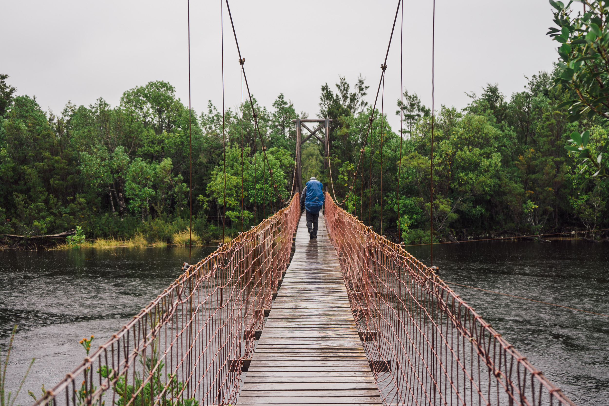
Day 1 of the hike in Tantauco Park on the Island of Chiloé (photo by Andreea Lotak)
Chile’s Greater Island of Chiloé, at the northern end of Patagonia, is the second largest island in Chile, after Tierra del Fuego. To its west lies the Pacific Ocean, and to its east lie the Gulf of Ancud (Golfo de Ancud) and the Gulf of Corcovado (Golfo Corcovado). The latter hosts a large population of blue whales. Chiloé is a common tourist destination for Chileans and international travelers as well, largely because of its relative ease of access from the city of Puerto Montt, and because of its rich history and unique wooden architecture. Most visitors to the island do not make it much further south than the city of Castro, but for those that are looking for an adventure through some of the last remaining old growth forests on Chiloé, the southern tip is where to go. Tantauco Park, or Parque Tantauco, is a well-built, well-managed conservation project that is working hard to protect and restore the extremely rare Guaitecas cypress and its ecosystem. For visitors, the park hosts over 130 km of well-built trails, as well as domes, a lodge and backcountry cabins, which in a way offer a “luxurious backpacking” experience.
CONSERVATION ASPECTS:
The region in which Tantauco Park sits has been declared as one of the 35 key sites of biodiversity on Earth. One of the primary species of concern in Tantauco Park is the Guaitecas cypress tree (Pilgerodendron uviferum), the southernmost conifer in the world. This extremely slow-growing tree has suffered severe deforestation and habitat loss over the last century, and Tantauco may be the best place to observe this tree’s ecosystems being conserved and restored. As we learned while talking to the park staff, the seeds of this species of cypress, once they take root, take two months to grow their first three centimeters. Given the rarity of this tree, the ecosystem it produces is also rare. Inside, one can see a variety of species that are difficult to see in other locations, some of which are described at the bottom of this page.
It is important the respect this delicate ecosystem. The park has put up signs that help inform visitors of how they can ensure they keep their impacts to a minimum, but as a general rule of thumb:
Practice the seven principles of Leave No Trace
When doing the Transversal Trail, make sure to bring out all trash that you bring in (which is part of Leave No Trace, but worth emphasizing). Also note the sponges to clean your boots when you enter the trailhead: this is to ensure you do not bring any fungi or harmful bacteria into the area from outside.
If you see a Darwin's frog/Ranita de Darwin, don't touch it! Take photos of it in its natural setting, which is usually on the ground or in the muddy leaves :). The oils from your hands can harm them.

GETTING THERE:
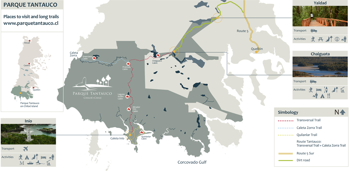
There are two main entry points for Tantauco Park:
1) The main park entrance is in Yaldad, which is accessible via 18km of dirt road from the main Ruta 5. Here one can hike several short trails, or drive another 20km to the offices in Chaiguata, which also host a number of short trails, as well as the trailheads for the main Transversal Trail and for the trail to Caleta Zorra.
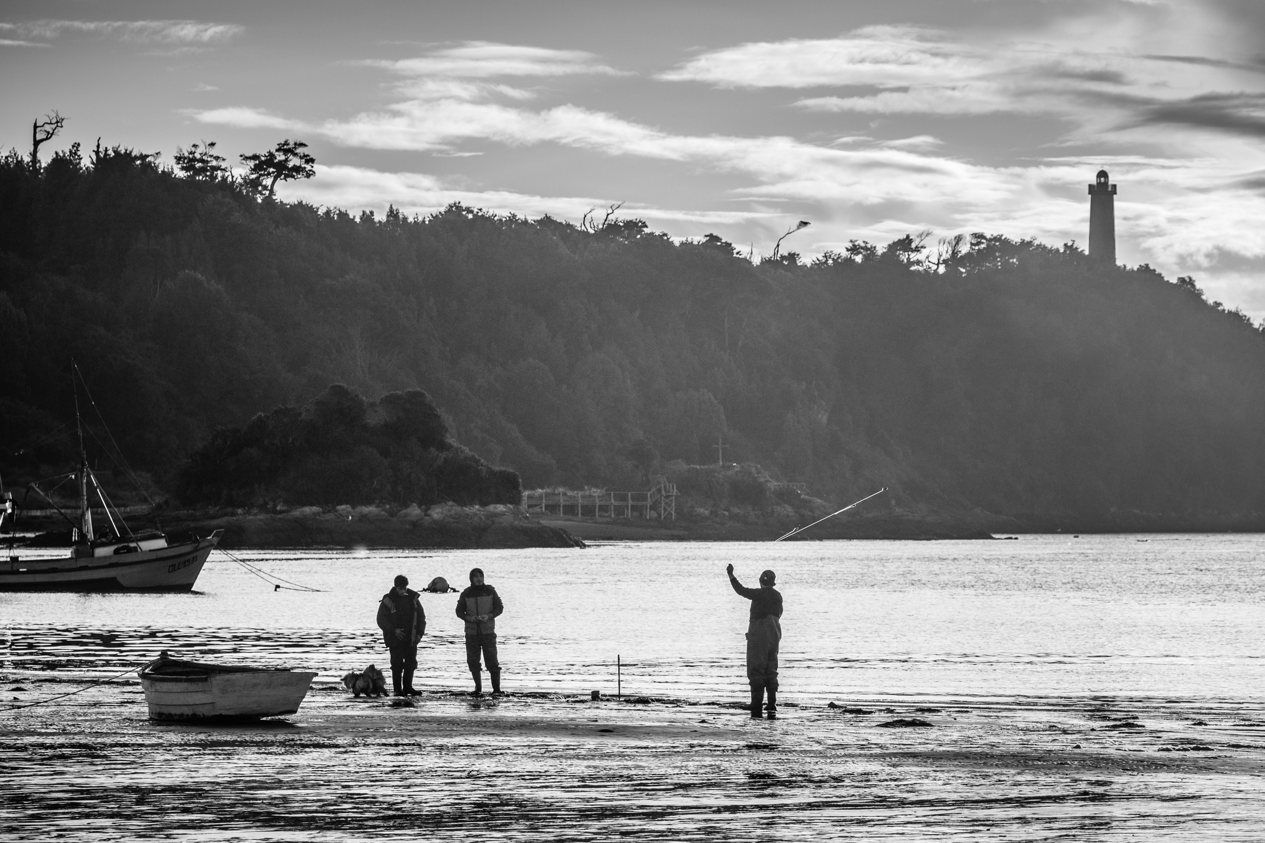
2) A second option is to arrive in the small fishing village of Inio, either by taking the twice-per-week (subject to weather) public ferry from Quellón, or by light aircraft (which Parque Tantauco offers). Inio hosts kayaking opportunities, a long day hike, whale watching tours, access to archeological sites of Chono indigenous people, and the trailhead of the Transversal Trail in opposite direction.
DETAILED DESCRIPTION OF TANTAUCO’S TRANSVERSAL TRAIL:
The best short description we can provide after spending several days on the Transversal Trail of Tantauco Park is that the hiking is wild and rough, but the accommodations at the end of each day are very comfortable. In a way, this should be the definition of “glampacking”, though a Google search of the term will provide very different results. This trail was unlike anything else we experienced in Patagonia, and we highly recommend coming to this conservation area to backpack Tantauco’s Transversal Trail, and taking the recommended five days to do it.

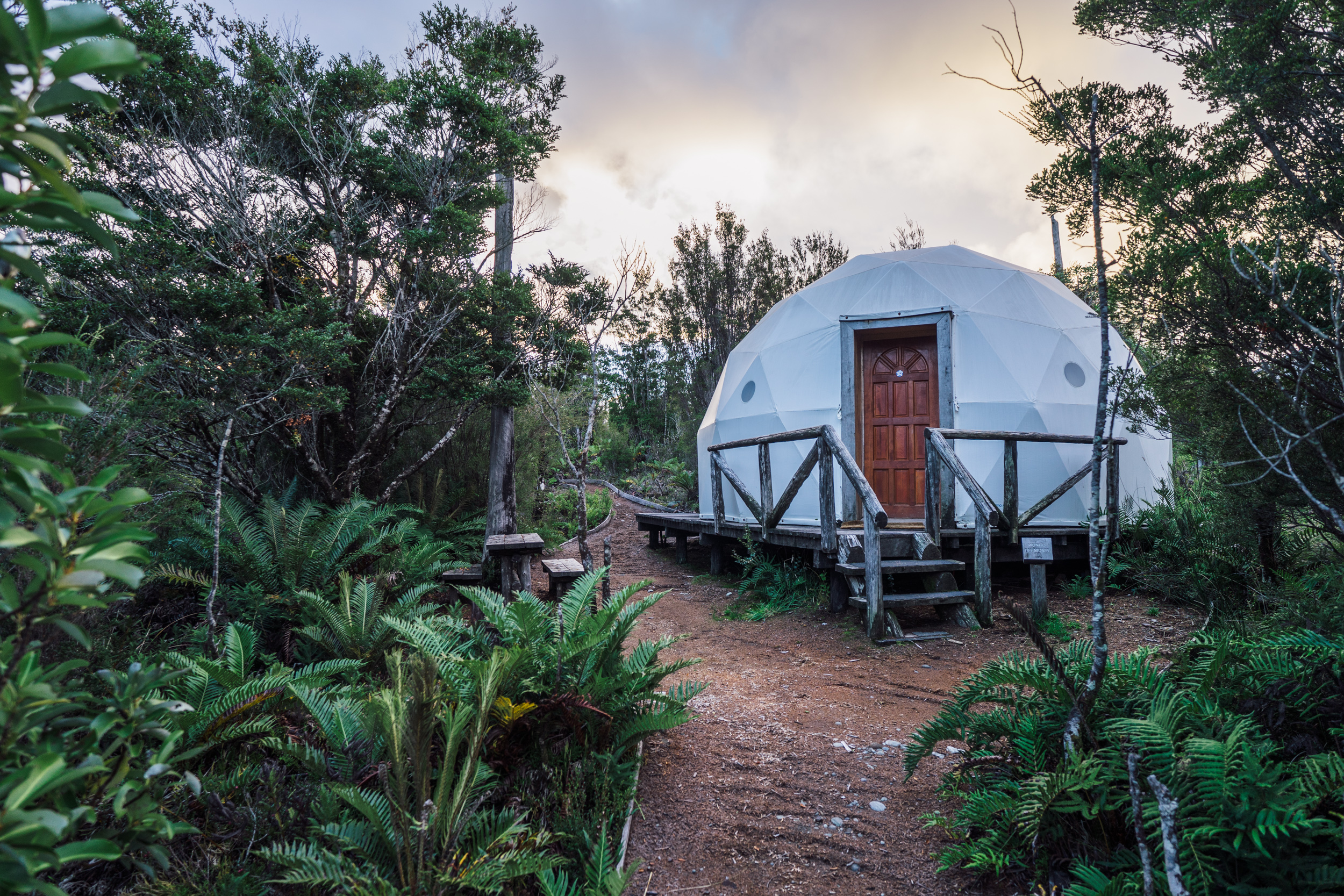
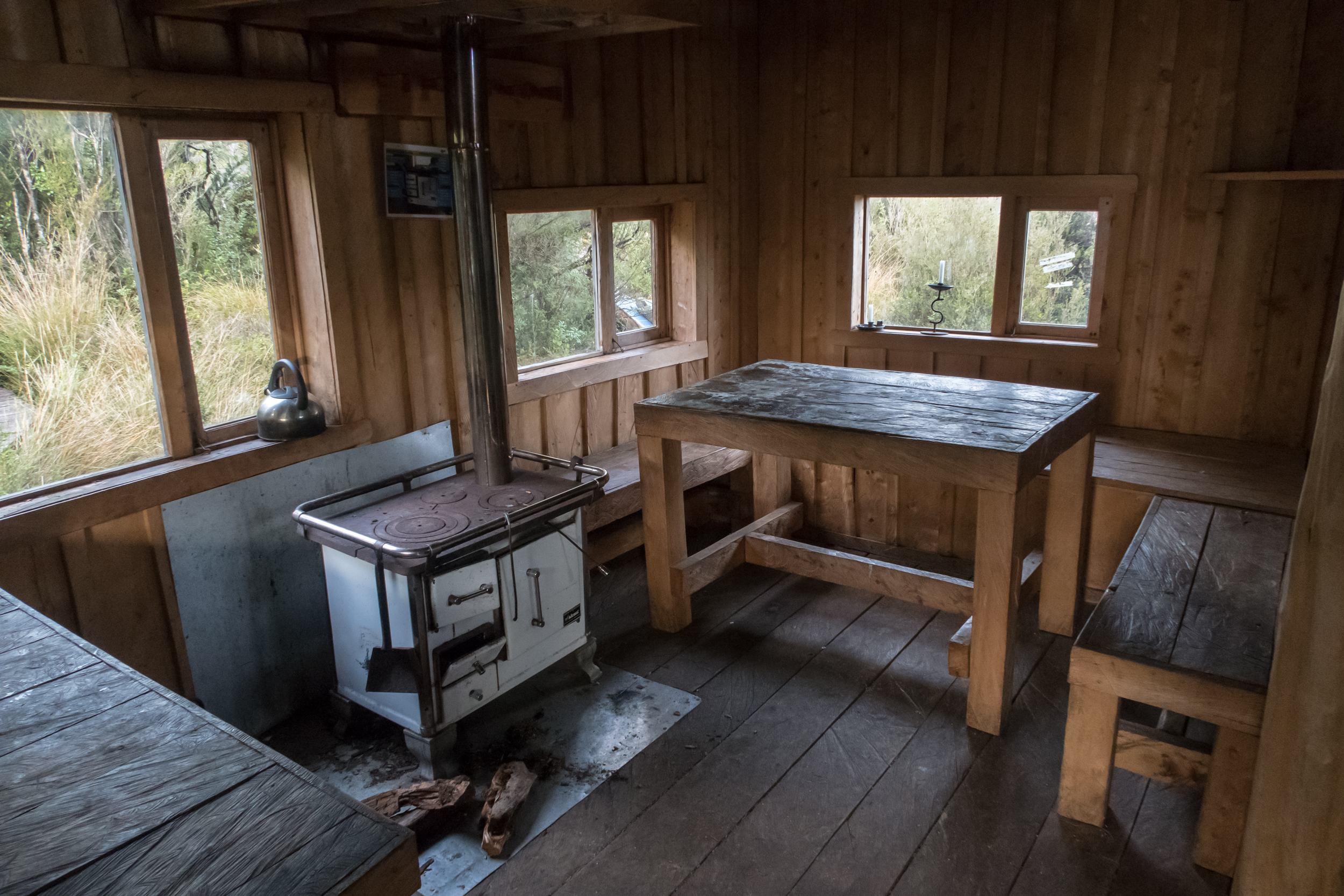
In Chaiguata, there are very nice domes in which to stay. They have comfortable beds with down comforters and heating. And, if one reserves these in advance, there are rustic hot tubs that use firewood for heating, with views of the surrounding forests and lake. There are also campsites, a kitchen, and a store in the park office which can supply a few basic necessities and souvenirs.
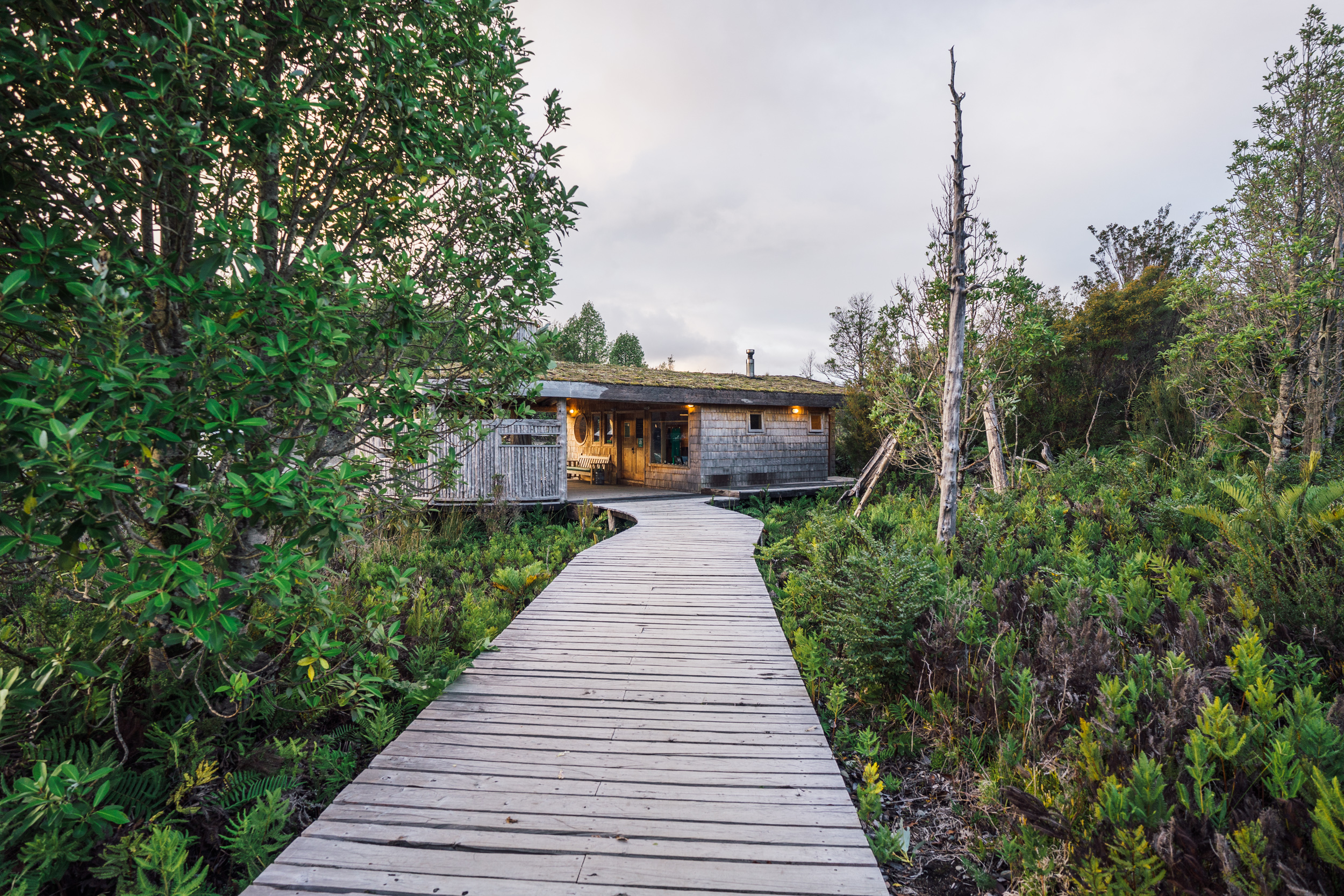

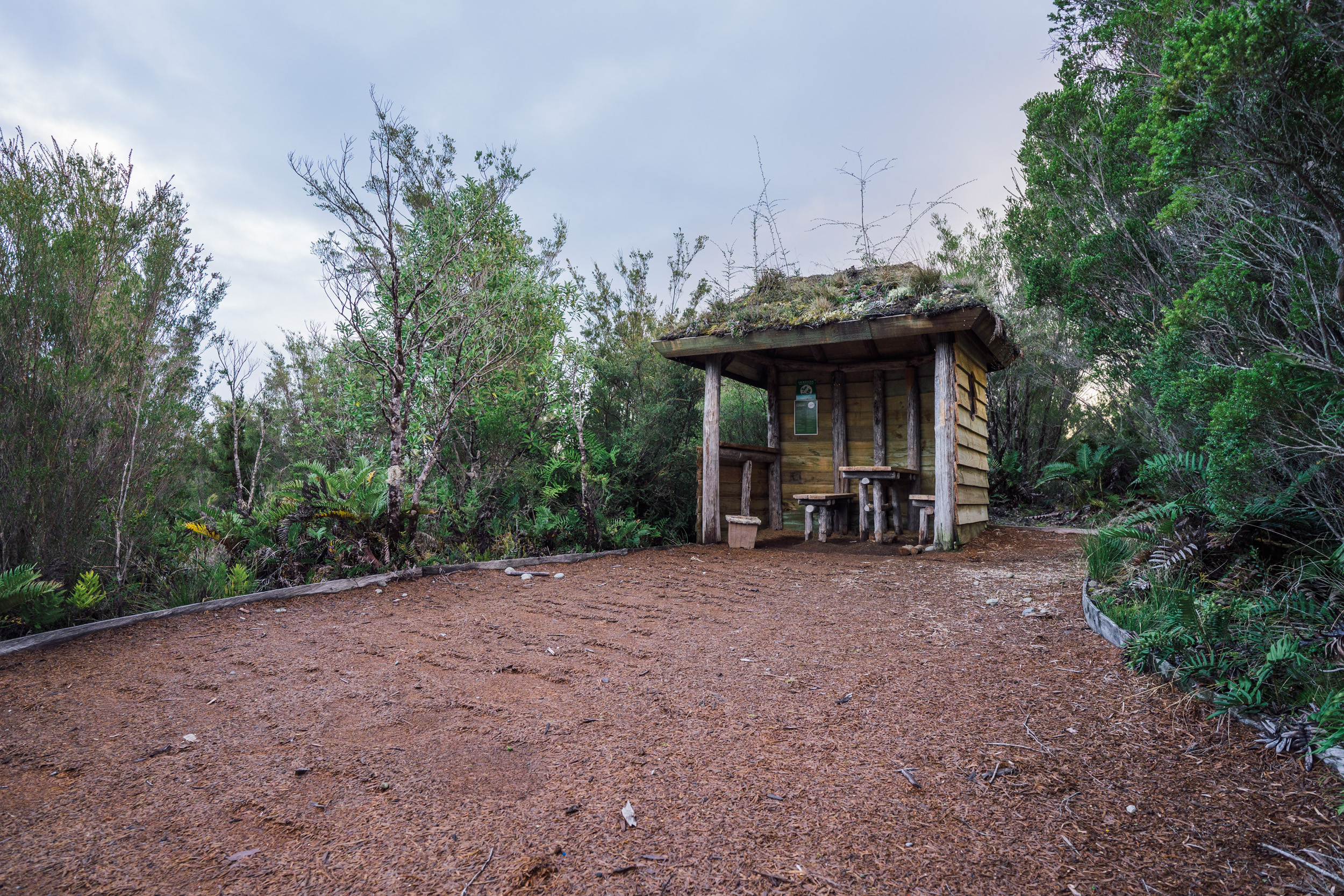
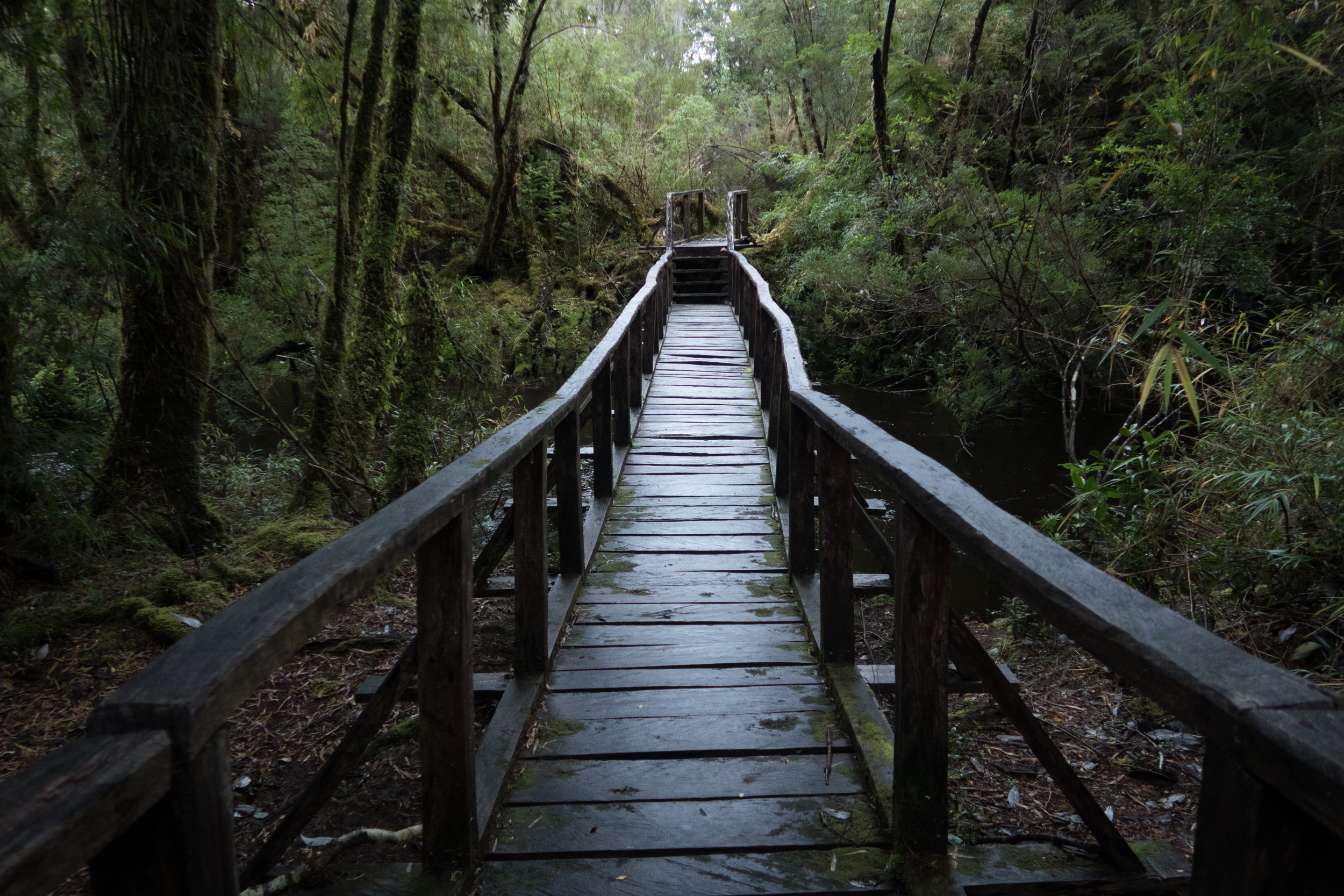
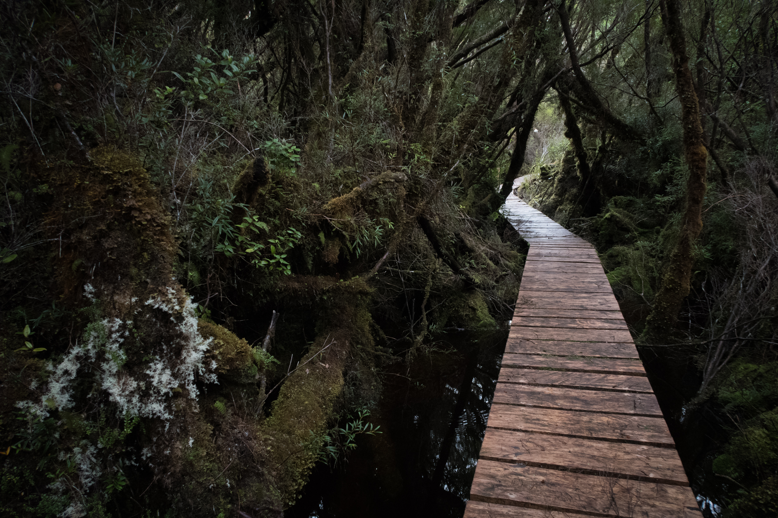
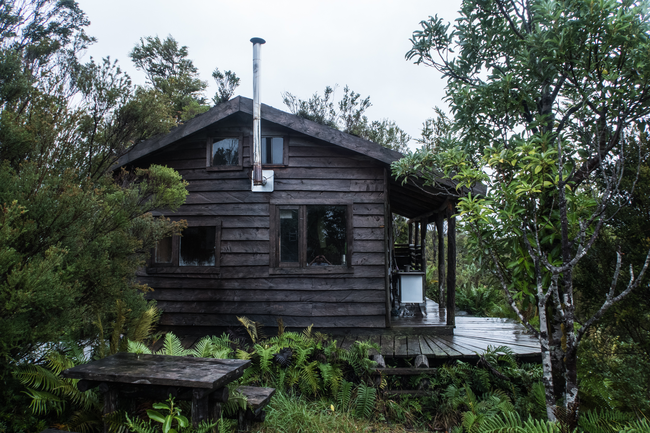
Starting in Chaiguata, it is a 52km hike from there to Inio. Although much of the trail consists of constructed wooden footpaths, the sections in the heart of Tantauco can still be rather wild and wet. The dark temperate rainforests of the region seem a little scary when you are so remote, and if foul weather precedes your visit, expect to hike in ankle to almost waist-deep water in a few sections. The wood can be slippery and the trail can include lots of tripping roots, but at the end of each day awaits a well-built cabin with a wood burning stove and a dry place to lay your sleeping mat and bag.
On the Transversal Trail, there are four rustic cabins spaced well throughout the route: the Chaiguaco Cabin, the Pirámide Cabin, the Laguna Huillín Cabin, and the Mirador Inio Cabin. There are one night limits on each of these cabins, and reservations are required in advance. There are places to camp as well near the cabins, but, given the climate of this region (and the reasonable prices), we highly recommend making use of the clean, well-built cabins and their wood burning stoves. The distances between cabins are as follows:
Chaiguata - Chaiguaco: 7.5 km
Chaiguaco - Pirámide: 12.5 km
Pirámide - Laguna Huillín: 15.4 km
Laguna Huillín - Mirador Inio Cabin: 7.5 km
Mirador Inio Cabin - Inio: 9.6 km
When we hiked this trail, we planned to do it in three days. The distances make this possible, though now looking back, we’d recommend taking five days to do the trail. The cabins between sections of the hikes are just so nice that it makes sense spend some extra time at each of these locations. Each offers views of either pristine lakes or the coastline, and when you’re soaking wet from head to toe from hiking in the rain and peat, you’ll appreciate these refuges to dry out and rest.
We could not have timed our visit worse from a weather perspective. A Pacific storm was raging outside during the first two days of our hike. The rains inundated the peat bogs as well as certain forest sections of the trail, where we hiked in thigh-deep cold black water. These parts in a way seemed out of a bad dream: coming up to a flooded area where the only way to continue was straight through, and with the root-covered grounds and dark water we had to feel our way through with our feet. We did the hike in late April, so our days were much shorter than they would have been in the summer, often causing us to race to get to the next cabin before sunset.
At the end of the trail, one arrives at the beautiful small fishing village of Inio. Here, there is a very nice lodge that is part of the park, at which we highly recommend staying. It’s a nice way to finish off a tough backpacking trip and to fully dry out. If one has the time and energy, there is the 22 km Quilanlar loop trail as well, accessible from Inio and which offers some of the most picturesque views of Tantauco.
And finally, you’ll notice on the map at the bottom, there is another trail called the Caleta Zorra Trail, which goes to the Pacific coast. This trail is 43 km round-trip from the Pirámide Cabin. We did not hike this route, though talking to the park staff, we were told that it is much rougher than the Transversal Trail, and that during wet weather, there are some areas that may become impossible to cross. Please take caution on this route, and only go if you are an experienced hiker.

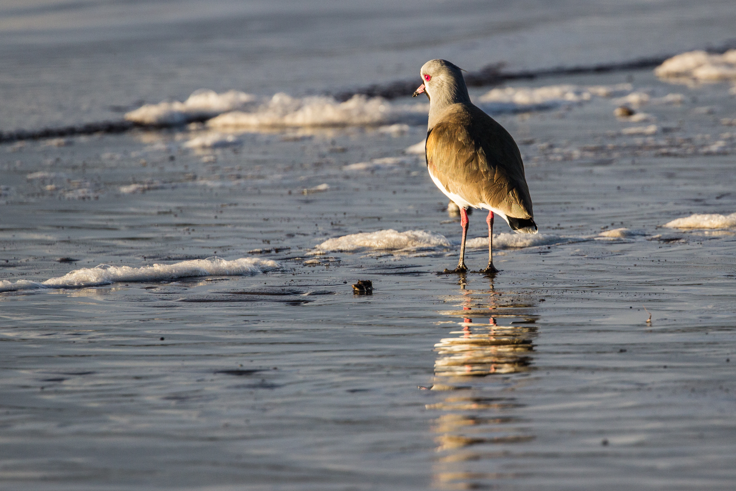
SPECIES TO NOTE:
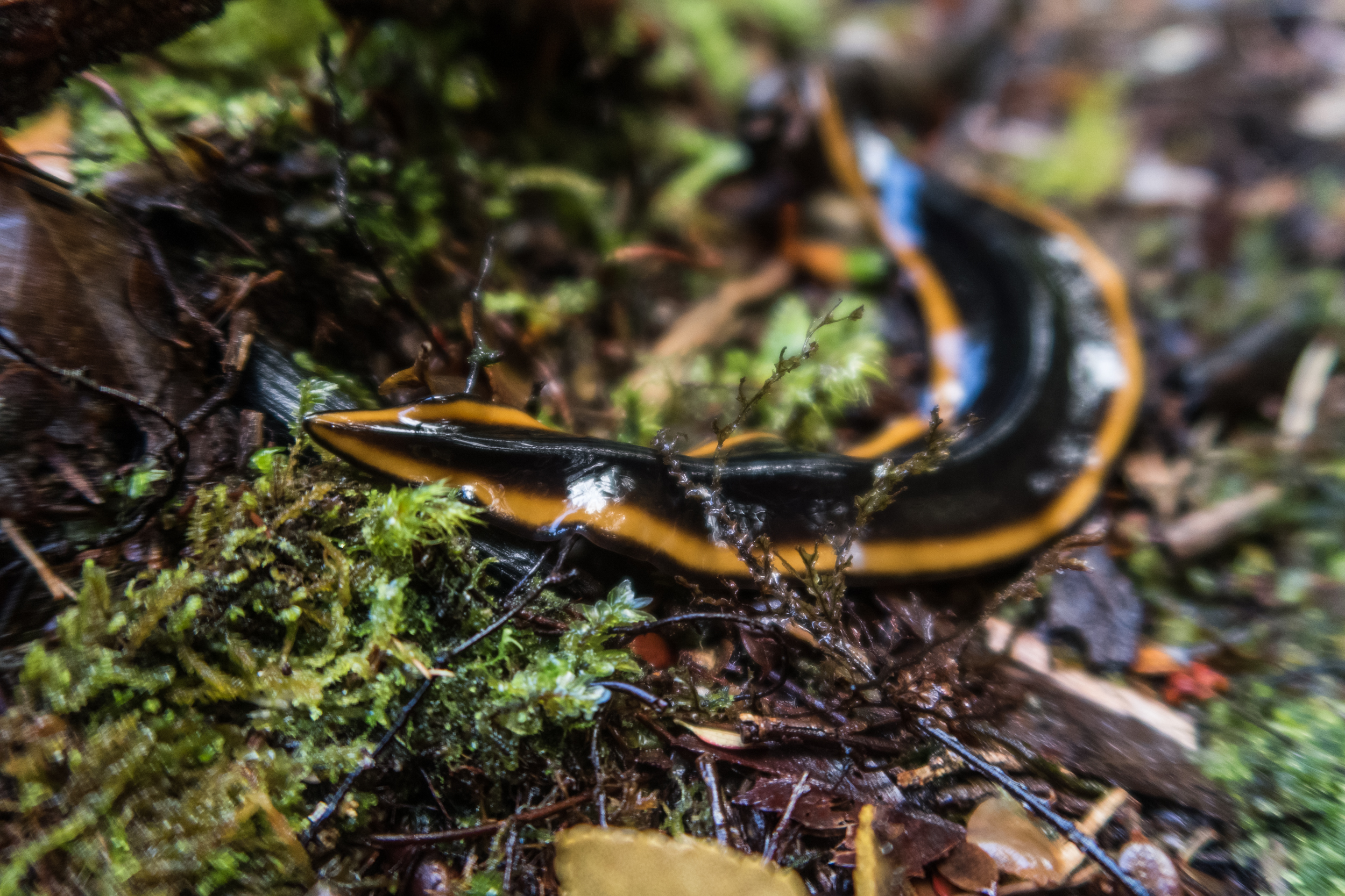
Darwin’s frog (Rhinoderma darwinii): This emblematic frog can be difficult to spot, given its unique camouflage and small size, but if you’re lucky enough to see one, you’ll be rewarded with a beautiful and strange little sight. Usually about 2-3 cm in length, the Darwin’s frog (or in Spanish: Ranita de Darwin) can be vivid shades of green or various shades of brown, but all of them have a pointy snout. They are usually found on the ground, blending in with the leaves. One special item to note about the Darwin’s frog is that after the female lays her eggs, the male guards them until they begin to move, at which then he gobbles them up and stores them in his vocal sac until they hatch, become tadpoles, and develop until they are able to hop out of his mouth. According to park staff, studies have been done that show the populations of Darwin's frogs in Tantauco are some of the healthiest in Chile, with no signs of chytrid fungus which has been killing frogs elsewhere in the Andes.
Southern pudú (Pudu puda): The pudú is the world’s smallest deer and has two subspecies: the northern pudú which is found in Colombia, Venezuela, Ecuador, and Peru; and the southern pudú which lives in Chile and Argentina. They are only 13-18 inches tall, and up to 33 inches long, with antlers that can grow to be 2.1-3.5 inches. Listed as near threatened by the IUCN, the southern pudú has seen its temperate rainforest habitat largely depleted, and it has been overhunted. Tantauco is one of the best places to see the strange-looking southern pudú in its native habitat.
A blue whale going for a dive
The elusive pudú. (sorry for the image quality - it was taken through a rainy cabin window at dusk)
Darwin’s fox (Lycalopex fulvipes): Also called Darwin’s Zorro or the Chilote fox, this small canine can be found on the island of Chiloé as well as a few areas in the Araucanía and Los Ríos regions of mainland Chile. Deemed as Endangered by the IUCN, the large majority of its remaining population reside on the main island of Chiloé, which hosts somewhere between 200-450 individuals. They are most easily seen during sunrise and sunset and often use the human trails to move about, as visitors will notice based on the amount of Darwin’s fox feces they come across.
Blue whale (Balaenoptera musculus): The blue whale is the largest species known to have lived on earth and, rather quite recently, a population of blue whales was found to live in the Gulf of Corcovado, rounding the southern tip of Chiloé during the Austral summers. When taking the ferry between Inio to Quellón, watch for this majestic species. Whale tours are also offered with various agencies on Chiloé.
Southern river otter (Lontra provocax): Also called the Huillín otter, this species is often seen in both marine and freshwater environments, despite its “river otter” name. They grow up to about 2.5 feet in length, and feed primarily on fish, crustaceans and mollusks. There are seven known populations of this species, all throughout Chile and Argentina.
Caracol negro (Macrocyclis peruvianus): This large black land snail has a brown shell that can grow to 4.5-6 cm in diameter, and it moves slowly (as snails do) throughout the temperate rainforest floor. It is quite uncommon to see, despite being the largest land snail in Chile. It is easiest to see in dark areas or when the sun is not out, preferably in or just after a rain.
A southern Darwin's frog in the peat bogs of Tantauco
Before heading out on this hike we had the chance to sit down and talk to Alan Bannister, General Manager of Tantauco and Javiera Lucero, Guest Coordinator in the main office in Castro. Go here to read the blog post about conservation efforts in the park and to gain an insight into its importance.


On a land destined to be logged, some of the most pristine valdivian temperate forests are now protected by this Nature Conservancy reserve. With its rugged coasts, ancient trees, impressive sand dunes, and local culture, it is a beautiful place to explore. Interview with Liliana Pezoa, administrator of the reserve.