FIFTEEN ADVENTURES IN 15 NATIONAL MONUMENTS
Text: Andreea Lotak; Photos: Justin & Andreea Lotak · 15 min read

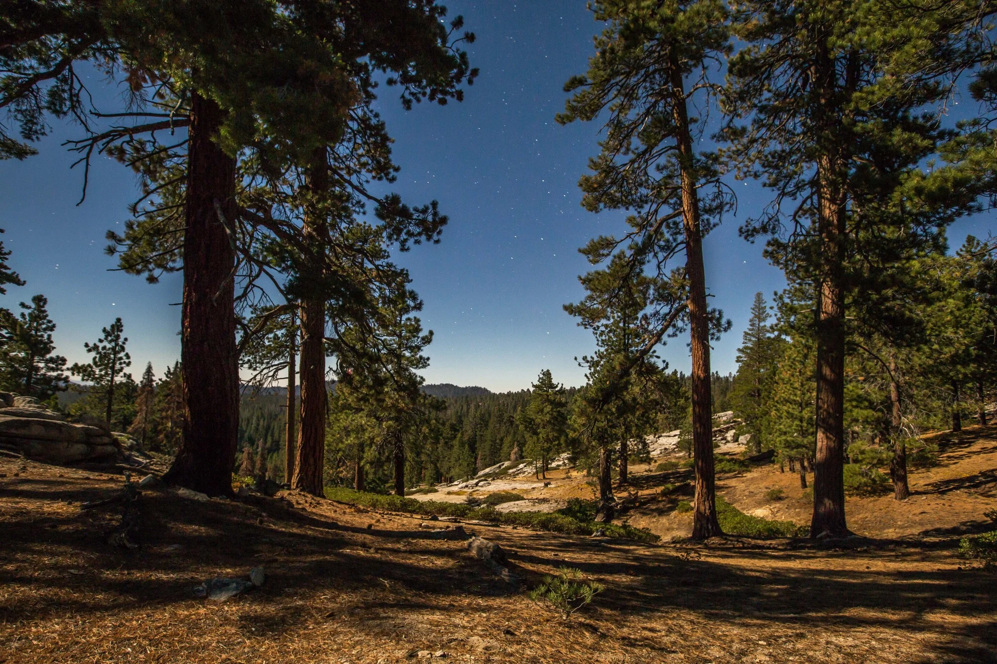
Nighttime outside the tent in the Giant Sequoia National Monument, surrounded by the Sierras
From the calm waters of the Missouri River to the lush Pacific Northwest forests of the Cascade and Siskiyou ranges, national monuments in the West cover a wide range of ecosystems and display a diverse array of wildlife and landscapes. If you’re looking for new adventures in 2018, consider adding these beautiful public protected lands to your list, which came under threat this past year.
Many of us head to national parks to get inspired by stunning landscapes, backpack, camp, climb or learn about biodiversity. There are well over 300 million annual visits to the lands managed by the National Park Service (NPS). By comparison, national monuments fly a bit under the radar, despite the fact that their importance, and the beauty and wildness of the landscapes they protect, is equally impressive. When President Trump announced a review of 27 national monuments, opening them up for potential extractive industries, his actions also triggered a positive reaction: people became more aware of these beautiful public lands, spoke loudly in their favor, read about them in the media, supported local organizations protecting the monuments, and headed out to discover them. Between August and November 2017, we visited twenty national monuments in the West that were on the review list, getting to experience in depth what these places represent. Below you’ll find a selection of things to do in 15 of the monuments we’ve visited. All of them are or were targeted for changes or reductions in size by the presidential administration, and they need our full awareness and appreciation.

Left: Kilbourne Hole in Organ Mountains-Desert Peaks National Monument is a site of geologic and historic importance, used as training grounds for the Apollo missions. Right: The Organ Mountains, site of the first battles between Union and Confederate soldiers in New Mexico, are now a favorite recreation area in the monument.
1. Feed Your Appetite for History and Exploration in ORGAN MOUNTAINS-DESERT PEAKS NATIONAL MONUMENT in New Mexico
This national monument designated in 2014 covers over 500,000 acres where a millenary history has left behind a strong heritage. From petroglyphs of ancient tribes, to Apache trails, the Camino Real, the Butterfield Stagecoach Trail, Civil War vestiges, historic ranches and settlements, and all the way to WWII bombardment ranges and Apollo mission training sites, this monument has it all. Aside from its historic and cultural heritage, it’s also a place of amazing geology, with volcanic fields and impressive mountain ranges. In the Desert Peaks area we saw the largest density of lizards in any of the twenty national monuments we visited. If you want to discover and learn more about the human record and the biodiversity of this national monument, the local outfitter Southwest Expeditions offers guided trips and backpacking adventures that will introduce you to the best the region has to offer.

Left: Cascade-Siskiyou National Monument hosts one of the largest diversities of butterflies in the US. Pictured here is an Atlantis fritillary. Right: A female woodpecker picking through the moss and lichens.
2. Be a Citizen Scientist in CASCADE-SISKIYOU NATIONAL MONUMENT in Oregon/California
Cascade-Siskiyou is the only national monument designated for its unique biodiversity and ecology. It is a place where different mountain ranges with different geology and biodiversity converge, creating a rich landscape where plants and animals that aren’t normally found living in the same place coexist. Sadly, Cascade-Siskiyou is also one of the monuments recommended for a reduction in size, despite the fact that over 200 scientists have argued for an expansion to better protect the amazing ecology of this region. The Friends of the Cascade-Siskiyou group organize annual “BioBlitzes”: events where scientists and volunteers come together to count and observe species of amphibians, butterflies, fungi or conifers. Sign up here for an upcoming one. Events like this or guided trips by local non-profits working in the monument can help you fully experience the place and understand its complexity and importance for science.

Reaching the top of the Blue Ridge-Homestead hike at Berryessa Snow Mountain National Monument, with views of the Berryessa Lake.
3. Learn About Fire Ecology in BERRYESSA SNOW MOUNTAIN NATIONAL MONUMENT in Northern California
The entire state of California has been covered in smoke from the megafires of 2017, which have burned over one million acres and many properties, making this the most destructive wildfire season on record. Scientists are working in many areas to study the ecology of wildfires and learn how they impact the biodiversity of a region. Shortly after the Berryessa Snow Mountain National Monument was designated in 2015, a wildfire charred its southern end, located only 1.5 hours north of San Francisco. Here, the University of California-Davis has been studying wildfire ecology to monitor the recovery of wildlife and vegetation. They are managing the Stebbins Cold Canyon Reservein the monument, where you can hike the Blue Ridge-Homestead loop and see for yourself how the landscape is coming back to life after the wildfire. This was one of the most beautiful ridge hikes we’ve done, as we chose to catch the sunset up top and hike down partially in the dark. Hiking at night can be treacherous on the ankles and is only recommended if you are comfortable with it and have a good light. Stay cautious as this is an area where rattlesnakes are common.

Left: Our canoe parked for the night at the first campsite after Coal Banks Landing, in Upper Missouri River Breaks National Monument. Right: Prairie dogs at sunset behind one of the campsites.
4. Float Down the UPPER MISSOURI RIVER BREAK NATIONAL MONUMENT in Montana
This monument protects the last free-flowing section of America’s longest river, the Missouri. All the hiking trails within it are only accessible from the river, so if you want to experience the beauty of these landscapes, you’ll have to hop in a canoe and float down for a few days. Most paddlers start at Coal Banks Landing and continue for three or four days down to Judith Landing, or beyond that for eight days all the way to James Kipp. Once you find yourself in the middle of this beautiful river, you’ll feel like you’re taking a trip back in time. The serene landscape looks like it’s coming straight out of a painting from the 1805 Lewis & Clark Expedition. This is an experience that will connect the traveler to a time when the American landscape was wilder, despite the cattle that graze along the banks of the Missouri. It’s truly an extraordinary adventure to able to connect with the flow of a river that has been crossing this landscape for millennia.

Cadiz Dunes Wilderness in Mojave Trails National Monument. Whether you visit at sunset or at sunrise, the light on the dunes will make for an incredible landscape.
5. Hike Up Sand Dunes in MOJAVE TRAILS NATIONAL MONUMENT in California
At 1.6 million acres, this national monument is among the largest in the Continental US. It came to be in 2016, after more than two decades of work to protect the ecosystems of California’s Mojave Desert. The monument is a wonderland of rugged mountains, volcanic craters, fossil beds, Joshua trees, one of the best preserved original sections of the historic Route 66, and some of the most beautiful dune fields in the country. Within the Cadiz Dunes Wilderness you’ll find a landscape that will take your breath away with every sunset and every sunrise you’ll experience. Head here for a good explanation on how to reach the trailhead to the dunes.

Left: A chipmunk is inspecting us on the trail to the Baden-Powell peak. Right: Top views in the San Gabriel Mountains National Monument
6. Take a Break from the City to Summit a Mountain in SAN GABRIEL MOUNTAINS NATIONAL MONUMENT in Southern California
As the winding road takes you up to the Angeles and San Bernardino National Forests where this monument is located, views of downtown L.A. will still remind you that you’re only steps away from an urban sprawl. Once you reach the high ridges of these mountains, though, you’ll be in the heart of nature. This national monument is one of the most visited in the country due to its proximity to L.A. and other cities, but you can still find plenty of solitude within its 346,000 acres. If you’re up for a workout, choose one of the peaks over 9,000 ft to summit and reach 360-degree views of the region. We went up Mount Baden-Powell, the highest peak on the Pacific Crest Trail south of the Sierra Nevada range and the 5th tallest in the San Gabriel range. We started from Vincent Gap and made our way up along the switchbacks shaded by ponderosa and Jeffrey pines.

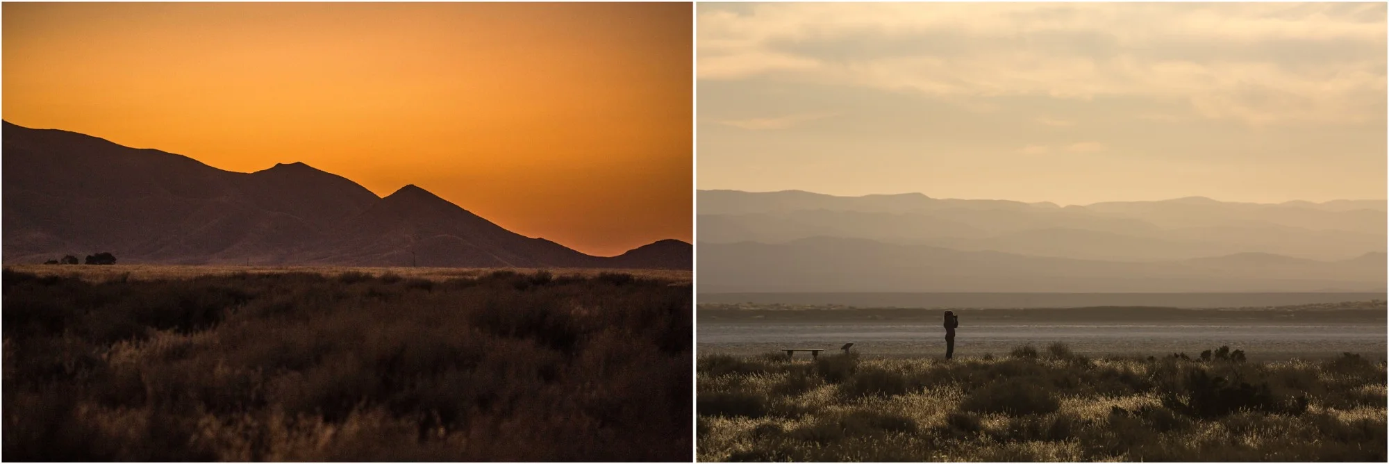
Left: The road through Coal Valley in Basin and Range National Monument was in good shape when we visited in November 2017. Right: A coyote in Garden Valley.
7. Take a Driving Tour of Nevada’s Last Wild Valleys in BASIN AND RANGE NATIONAL MONUMENT
When we spoke to one of the people involved in the creation of this national monument, he told us that the valleys are where we build our highways, farms, cities and so on; and that they are the places through which we think to drive in order to get to the places where we want to recreate in the mountains. So this national monument, dedicated to the vastness of Nevada’s valleys, is less about the impressive mountains surrounding it and more about taking the time to immerse yourself in the beauty of these open spaces. Soon you’ll start feeling like you’re at the edge of an ocean, observing its calming waves. On the more than 700,000 acres there are no designated hiking trails, except for the short walks around sites that harbor numerous petroglyphs. Head here for a full description of the 81-mile dirt road loop and the attractions along the way.

Left: In the pink light of sunset in Ironwood Forest National Monument, saguaro cacti and ironwoods stretch across a vast landscape. Right: A roadrunner on the side of the dirt road.
8. Catch the Sunset in One of Arizona’s Deserts in IRONWOOD FOREST NATIONAL MONUMENT
Located at the confluence of the Sonoran Desert and the Great Basin Desert ecosystems, this stunning national monument is also protecting the largest forest of ironwood trees. While this tree species that can live up to 800 years is the one that gave the name to the national monument, you’ll also find thousands of saguaro cacti, barrel cacti, and plant communities typical to both desert ecosystems. Living among them there are hares, lizards, roadrunners, deer, tortoises and more. There are trails that can be hiked, you can go up mountains such as Mount Ragged, or you can find the best spot to catch the sunset and wait for the magic there. And if you want to see more of Arizona’s deserts, you can head to the nearby Sonoran Desert National Monument, which was also under review by the presidential administration. Both monuments are only about an hour’s drive away from Phoenix and Tucson.
Left: The silhouette of the Caliente Ridge at sunset in Carrizo Plain National Monument. Right: Walking along the large alkali Soda Lake, with the Temblor Mountains in the background.
9. Observe Wildlife in CARRIZO PLAIN NATIONAL MONUMENT in California
This place made headlines last year with its super bloom, an explosion of colorful wildflowers which made it look otherworldly. We arrived there in October, long after the spring flowers were gone and the thousands of visitors had left. This is when time seems to slow down to a halt here, yet despite the high summer temperatures, the plain is full of life. Carrizo Plain is California’s largest native grassland, crossed by the San Andreas Fault and surrounded by mountains that rose from tectonic activity. The yellow grasses, the soft shapes of hills and mountains which seem covered in velvet, the light at sunset and sunrise, and the wildlife moving across the landscape all help you understand what the California Central Valley was like. This is the perfect place for observation, for taking a moment to breathe deep and appreciate the diversity that lives in a grassland. Bring a book, binoculars, your camera or just simply sit still looking at the open space. Spending a couple of days in this bliss will get you fully recharged.

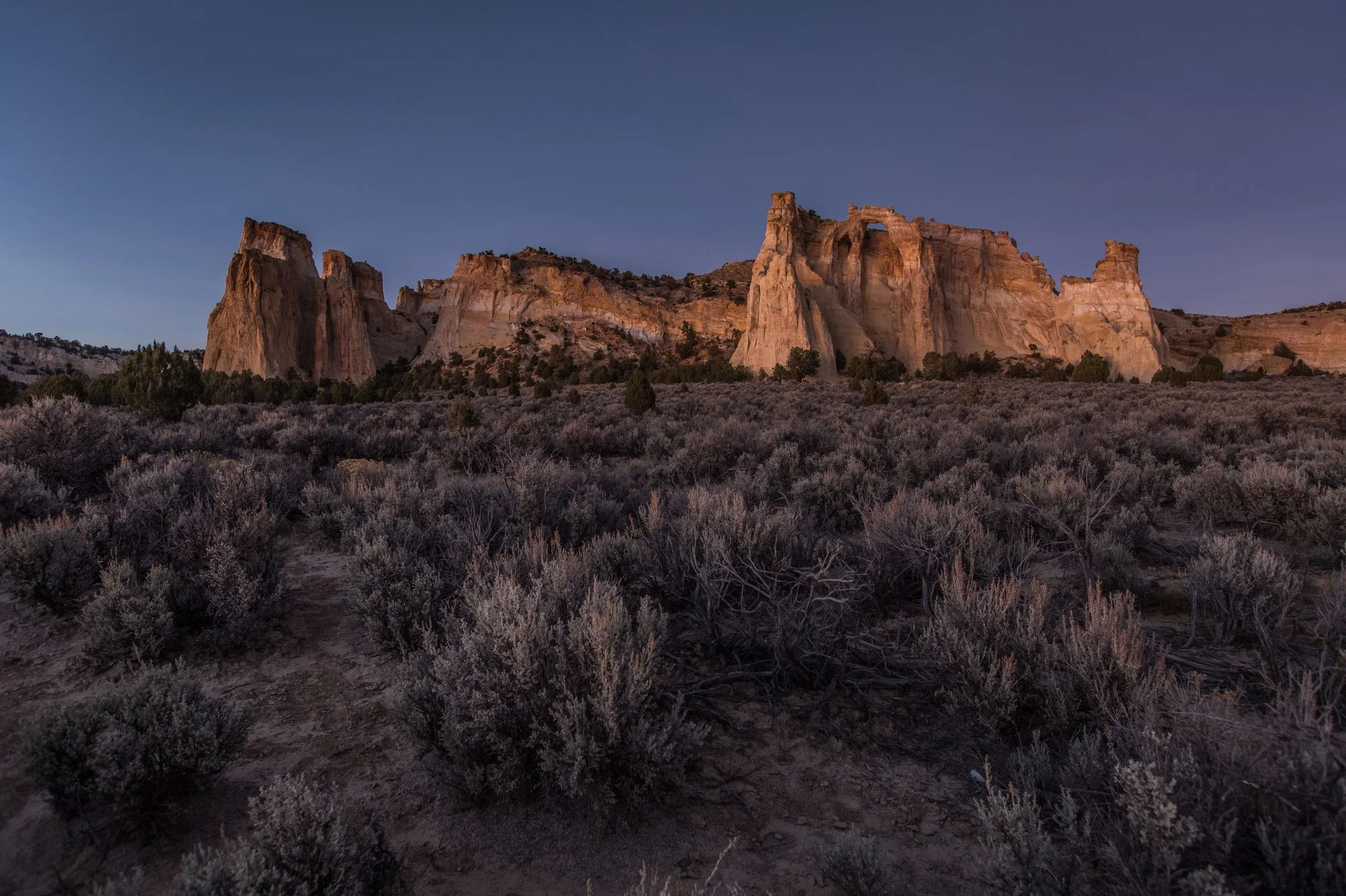
Left: A mix of water seeping through the sandstone and the iron deposits are what give color to these amazing formations, in Gold Butte National Monument. Left: The “Little Finland” area.
10. Discover the Amazing Geology of GOLD BUTTE NATIONAL MONUMENT in Nevada
This national monument, which Secretary of Interior Zinke recommended for a size reduction, is a true gem. If you want to be left without words while admiring some of the most spectacular rock formations, head here. The monument was designated in 2016 and it protects over 300,000 acres of natural and cultural resources that are truly unique to this landscape. Here you can find a relict forest from the Ice Age up in the Virgin Mountains, diverse rock and sand stone formations, bright orange dunes, and a human record spanning over 12,000 years. Its remoteness, however, requires plenty of precautions and preparations before heading out. If you want to get the best possible experience, sign up for one of the guided hikes that Friends of Gold Butte organize in the monument. That way you’ll learn about the colors of the rocks, the best places to marvel at what the water and the wind have sculpted, and to respectfully visit sites where ancient tribes have left behind dozens of petroglyphs.

Left: The Rio Grande and the Red River converge in Rio Grande del Norte National Monument. Both are great rivers for fly fishing. Right: There are several steep hikes that can take you down by the river, inside the deep gorge of the Rio Grande.
11. Go Fly Fishing in RIO GRANDE DEL NORTE NATIONAL MONUMENT in New Mexico
The monument was designated in 2013 by President Obama to include the Wild & Scenic Rio Grande River and expand protections to the Taos Plateau and its watershed. The Rio Grande is the state’s lifeline. It’s the largest river in the state, and whose might from the past has been substantially reduced by numerous dams and irrigation systems. While native species in the river, such as the cutthroat trout, have been severely depleted by introduced species like the rainbow trout, they are now starting to make a comeback along the Rio Grande. The Orilla Verde National Recreation Area in the monument is recognized as one of the most scenic and the best areas for fly fishing. Permits are required and they can be purchased at the Rio Grande Gorge Visitor Center in Pilar, NM. More information here.

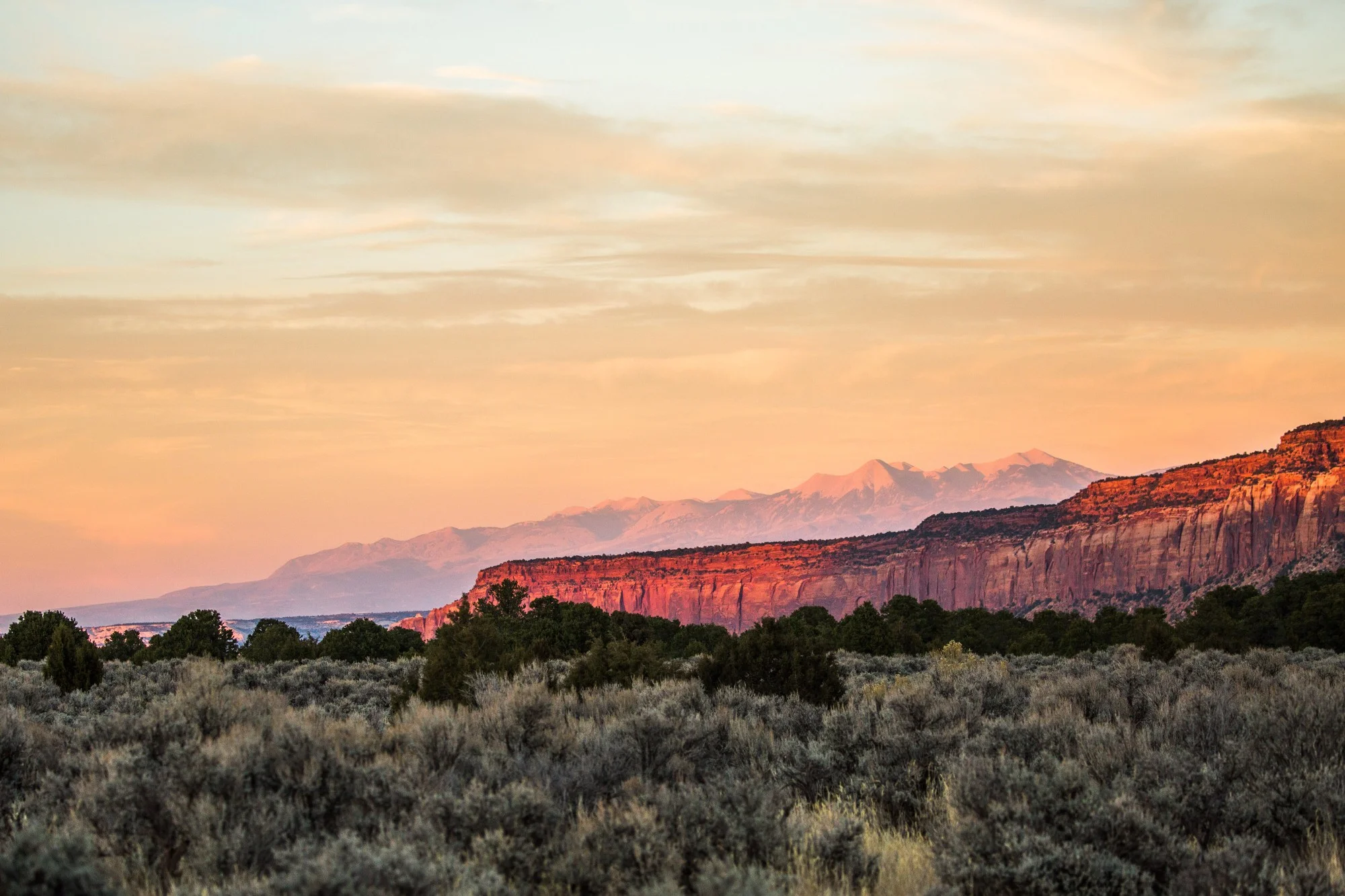
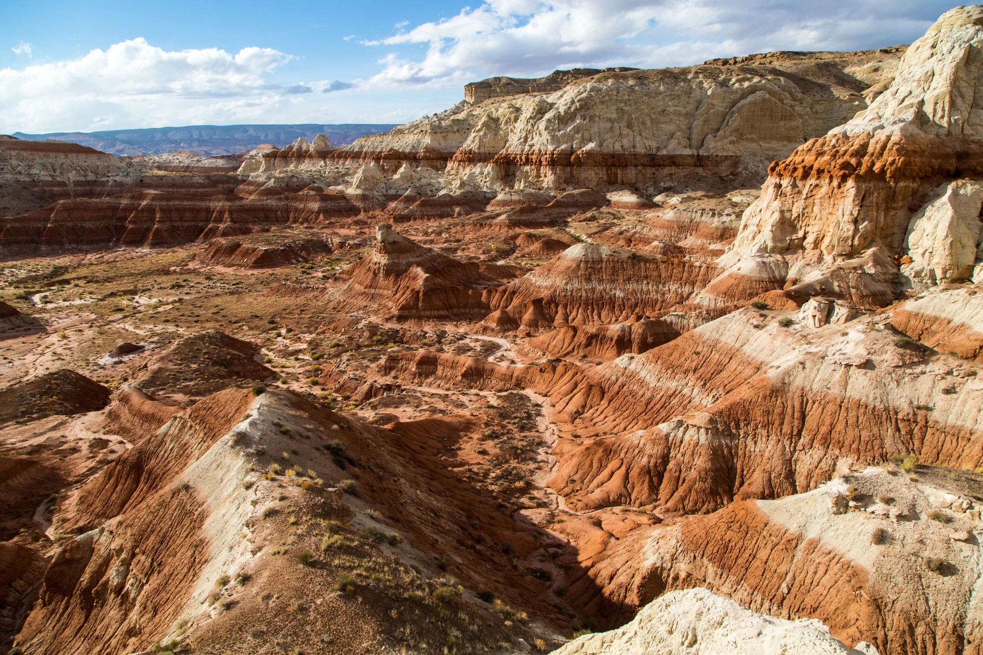
Left: The scenic route that winds through the Escalante region of Grand Staircase-Escalante National Monument, where dozens of slot canyons are found. Right: Inside the Spooky Canyon.
12. Explore the Slot Canyons of GRAND STAIRCASE-ESCALANTE NATIONAL MONUMENT in Utah
At almost 1.9 million acres, Grand Staircase-Escalante is a wild land of slot canyons, river gorges, mysterious rock and sandstone formations, and plateaus that hide some of the highest densities in the world of dinosaur fossils. This is a place teeming with adventure and recreational opportunities. The dozens of hidden slot canyons will give you the thrill of a lifetime, whether you’re hiking on your own, going horseback, canyoneering or rappelling down with a guide. The diversity of the canyons allows you to choose your type of adventure and level of intensity. This could be a good resource to help you choose a hike, but there are many guidebooks available for purchase, dedicated to hiking the canyons in the monument. On December 4, 2017, the President proclaimed that Grand Staircase-Escalante National Monument will be broken in three smaller, disconnected national monuments and will lose 46% of its size. Many of the slot canyons in the Escalante region are no longer protected under the national monument status. Visiting this place, voicing your concern to your senators and representatives, and supporting the work of those fighting to conserve it is now vital for protections to be upheld into the future.

Left: The morning light filters the smoke from nearby wildfires along the Trail of 100 Giants, in Giant Sequoia National Monument. Right: The Boole Tree in the Converse Basin Grove.
13. Bring Out Your Inner Child in GIANT SEQUOIA NATIONAL MONUMENT in California
No matter what age you are or how many times you’ve seen them, nothing can quite prepare you for standing under an ancient Giant Sequoia. The experience is almost of a sacred nature, and it reminds you of that authentic awe and enthusiasm of your childhood days. The national monument is part of the Sequoia National Forest and its southern section is adjacent to Kings Canyon National Park and Giant Sequoia National Park. While the latter has more impressive groves of these marvelous trees, you will encounter more solitary experiences in the national monument with opportunities to stare upwards without having to share the sight with anyone else. Pitching a tent in the monument means that you’ll catch the last light of the day over the Sierras, surrounded by giant ponderosa pines and overlooking the tree canopy through which the occasional sequoia pierces, towering above other giants. Relax and let that childhood joy for adventure take over.

Left: The sacred landscape of the Valley of Gods, in Bears Ears National Monument. Right: An Ancestral Puebloan settlement at Butler Wash Ruins.
14. Learn About Native Heritage in BEARS EARS NATIONAL MONUMENT in Utah
Bears Ears is the monument that potentially has suffered the most as a result of the presidential review in 2017. Alongside Grand Staircase-Escalante, it was Utah’s other monument announced to be drastically reduced in size. More than 85% of the original acreage was excluded and Bears Ears was broken up into two smaller national monuments. There are over 100,000 cultural and archaeological sites scattered across the original 1.35 million acre monument, and five Tribes worked together to see Bears Ears protected. The website of the Inter-Tribal Coalition for Bears Ears will give you a lot of good information on places to visit. The town of Blanding, UT has a good museum that can provide an introduction into the local native cultures. In Bluff, the Friends of Cedar Mesa organization is working to open up an Education Center which will be a useful resource for visitors. The original map of the national monument has some of the more accessible historic sites marked, but if you get a chance to sign up for a guided trip you will likely get a much fuller experience of the cultures in Bears Ears.

Left: The Whitewater River is a beautiful sight in the dry desert environment of Sand to Snow National Monument. You can pitch your tent nearby on one of the sandy beaches. Right: On the PCT.
15. Backpack on a Short Portion of the PCT in the SAND TO SNOW NATIONAL MONUMENT in California
From the Whitewater Canyon Preserve, managed by The Wildlands Conservancy as a gateway into the national monument, you can go on an overnight backpacking trip along the Pacific Crest Trail (PCT). You can choose whether you just want to venture out for one night or hike the whole 30 mile distance that the trail covers within the national monument. It’s a strenuous walk with many ups-and-downs and a substantial altitude gain, and that takes you up into the San Bernardino Mountains dominated by the San Gorgonio Peak at over 11,000 ft of altitude. The walk is known as the “Nine Peak Challenge” and it’s a one-way. In the winter, the low-lying landscapes of the desert contrast with the snow-covered ridges and peaks surrounding them.
Know what to expect: national monuments managed by the Bureau of Land Management (BLM) and the by the Forest Service have less infrastructure than national parks, and offer wilder, more remote experiences. Some are in truly rugged places, where you have to be completely self-reliant. Because these monuments receive much less funding and are more understaffed than national parks, any damage we cause or unwanted trace that we leave behind will be harder to erase. Artifacts and archaeological sites are more exposed and their preservation depends on our ability to visit respectfully. Enjoy, appreciate and respect your public lands!


To date, President Joe Biden has designated five national monuments since coming to office in 2021. Here we take a look at four of those five national monuments that had a land conservation element, and what might be on the slate before the end of his first term.