BASIN AND RANGE NATIONAL MONUMENT: Protecting Nevada's Wild Valleys
Text: Andreea Lotak; Photos: Justin Lotak · 4 min read

Coyote in Basin and Range National Monument, Nevada
"When you go to Basin and Range, you have to think about that notion of sitting on a beach and looking out at the ocean. And maybe there’s some waves, some kind of motion to keep your eyes moving. But it’s that same kind of serene feeling, similar to sitting on the prairie and looking at its vastness. Now, granted that at Basin and Range you have the mountains in the background, but when you’re really out there in the valley, those mountains are a long way away..."
— Jim Boone, Friends of Basin and Range
To say that Basin and Range took us by surprise would be an understatement. Its wide spaces and the valley vegetation of the Great Basin ecosystem reminded us of Chilean Patagonia. The national monument established in 2015 protects over 704,000 acres of wildness only mildly altered by ranching. Driving and walking through it is pure bliss and freedom. Two days later, when hiking through Nevada's other national monument on the review list, Gold Butte, we got to talk at length with Jim Boone. He is a member of the Board of Directors of Friends of Gold Butte and one of the coordinators of the Friends of Basin and Range group. Jim is an ecologist with a strong connection to these lands that he is now working to protect. Everything he said with his characteristically calm voice and at a slow pace was incredibly inspiring: "As a visitor to Basin and Range, you need to know that here it’s all about the basins (basin is a geology term for valley). Basins are normally the places where we put our highways, where we put our power lines, our cities, our industries, and our farms. They’re the places we drive through to get to the mountains where we want to recreate. For Basin and Range, you need to slow down and embrace the basins. You need to embrace the valleys. I encourage everyone that I send that way to drive the loop: in Seaman Wash Road and out Mail Summit Road. And I encourage them that when they get down into Coal Valley to stop and get out and just plan to spend 30 minutes. Maybe get out your lawn chairs, have lunch there. Spend a few minutes getting to know the valley, the basins."
Basin and Range has quite a fascinating story, too. As we learn from Jim, it was a group of artists led by Michael Heizer and his massive art project called "City" that opened the conversation to protect these incredible valleys. In the heart of one of the largest ones, Garden Valley, Michael Heizer has been working for decades to create an art installation on his property, and considered that without the wild valley backdrop his work would be pointless. His community reached out eventually to conservationists in Nevada who immediately realized the importance of protecting the state's last wild basins (technical term for ‘valley’, as Jim explained). These efforts landed in fertile ground when US senator Harry Reid (D-NV), embraced the idea and pushed forth to create the national monument. Jim and his partners are now working to raise a local group of people that would embrace the monument, while cultural and political barriers are driving the discourse in an opposite direction. "It’s the distrust in the federal government, that they will take the land away. The idea of transferring public lands to the states is popular." The latest news coming from the Department of the Interior after Secretary Zinke's review does not seem to threaten the integrity of the monument, and this should give the communities the necessary time to understand the benefits of having this impressive protected landscape in their backyards. Truly, this place is of extraordinary beauty and, like the Upper Missouri River Breaks, offers a glimpse into an ecosystem that has been slowly erased by development elsewhere.

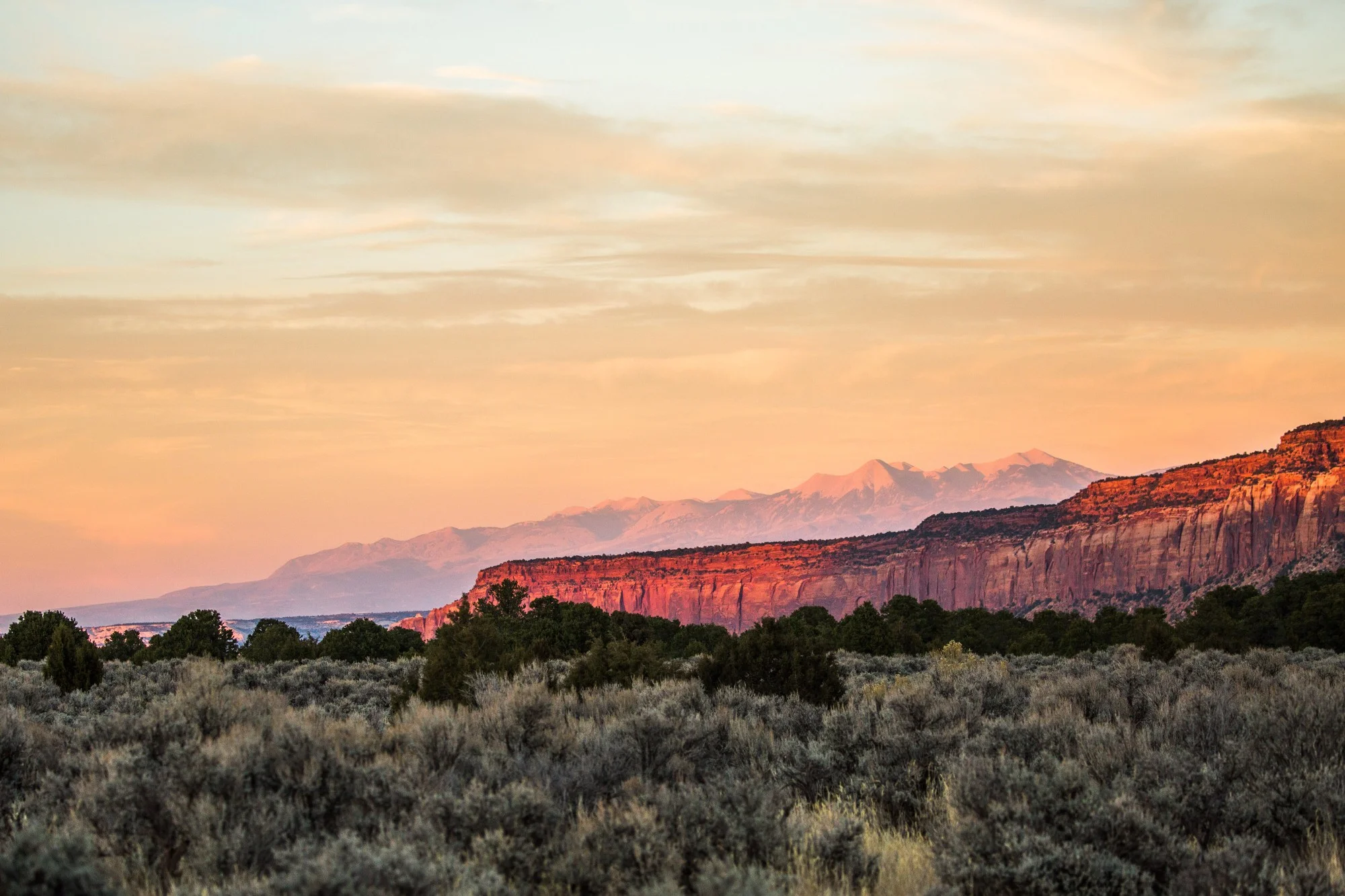
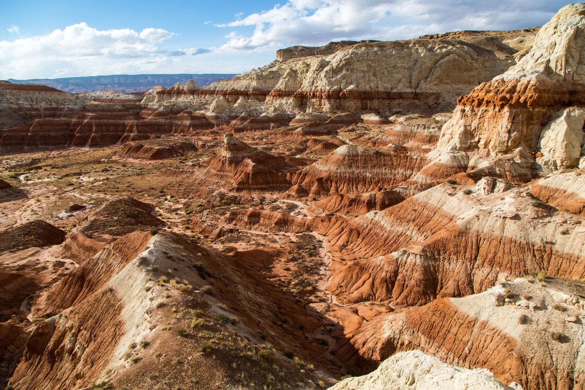
Mount Irish Wilderness seen from basin and range
Looking at the fragmented landscape of the Mount Irish Wilderness, where we spent the first night in the monument

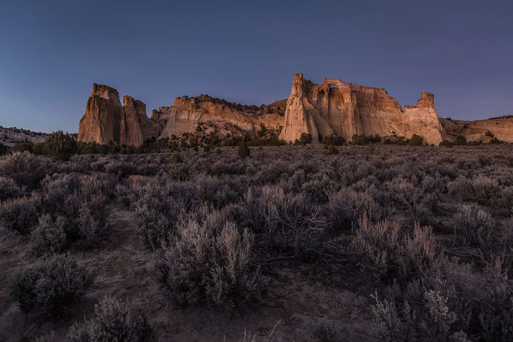
Mount Irish Rock Art and Archaeological District, basin and range
The Desert Archaic people and the ancestors of the Fremont and the Paiute people left in this area a treasure of petroglyphs. There are several sites within the national monument where the visitor can do a self-guided walking tour and witness pieces of this ancient history. One of the more accessible ones is in the Mount Irish Rock Art and Archaeological District.

An incredible sunrise at the southern end of the national monument, surrounded by the vegetation of the Grand Basin Desert ecosystem.

mail summit road
Mail Summit Road through Coal Valley. The road was in a very good condition for the most part when we visited in November 2017. Due to its remoteness it's always good to be prepared with extra supplies and a spare tire, as well as with a good map/GPS.

coal valley
Reaching the stunning Coal Valley, while driving a loop along the Mail Summit Road, through Murphy's Gap and out on Timber Mountain Pass Road. The more typical, shorter drive visitors take is Mail Summit to Seaman Wash Road, as Jim recommended.

Grazing cattle is allowed within the boundaries of the national monument and existing grazing rights were respected, as well as private property and proper access to it. Hunting and OHV activities are also allowed in Basin and Range in designated areas.

The valleys of the Basin and Range are surrounded and crossed by rugged mountain ranges that give the landscape a surreal beauty.

As Jim said, spending time to get to know the valleys, getting lost in their vastness, is similar to looking at an endless ocean.

Timber Mountain Road
The landscape changes and becomes drier, otherworldly after crossing the Seaman Range. Timber Mountain Road exits onto Rd 318, which then goes through a landmark area, the White River Narrows on the way back to the gateway community of Hiko.
For the best description of the driving loop through the national monument head to Jim Boone's website, which is probably the best online resource for exploring southern Nevada's outdoors.


To date, President Joe Biden has designated five national monuments since coming to office in 2021. Here we take a look at four of those five national monuments that had a land conservation element, and what might be on the slate before the end of his first term.