BERRYESSA SNOW MOUNTAIN NATIONAL MONUMENT: California's Great Unknown
Text: Andreea Lotak; Photos: Andreea & Justin Lotak · 4 min read

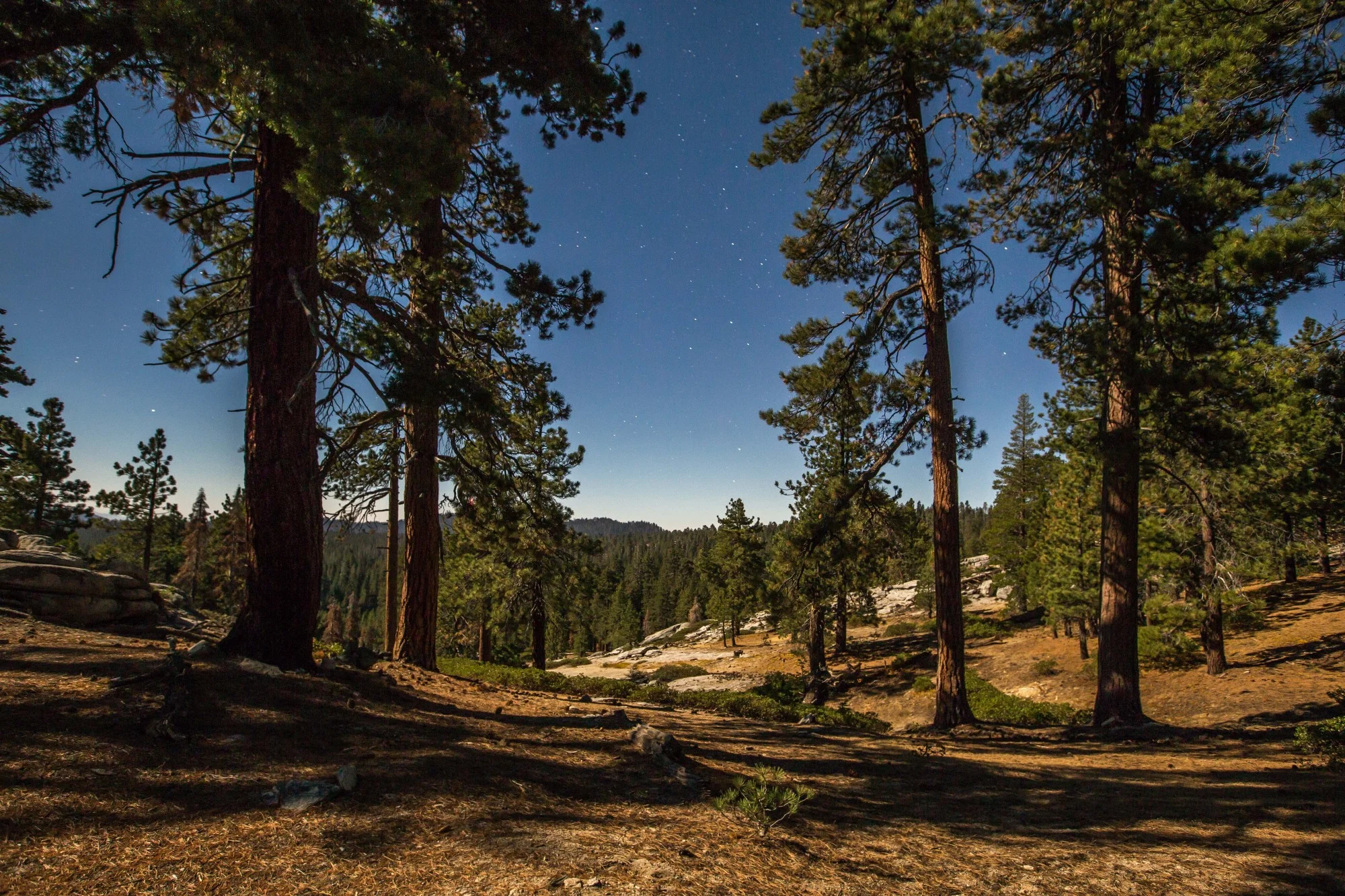
Snow Mountain Wilderness inside Berryessa Snow Mountain National Monument, California
A national monument stretching over seven counties was created in 2015 to protect impressive geological features, biodiversity and human history in northern California. We found that most people, including Forest Service employees, were unaware of its exact boundaries or even its existence. Yet, it was an area of stunning beauty that took us by surprise.
The approximately 330,000 acres of the national monument are managed by the US Forest Service, mainly as part of the Mendocino National Forest in the north, and by the Bureau of Land Management near Lake Berryessa in the south. Additionally, the University of California - Davis maintains a trail in a small section of the monument at the very southern bottom, where they are studying the effects of a highly destructive wildfire from 2015. All in all, the monument goes from the heights of the Snow Mountain at over 7,000 ft, covered in pines and California chaparral, to the oak savannah ecosystems in the middle portion, and the dry, arid mountains in the south.
We made our way into Berryessa Snow Mountain through the middle section, where in the sunset light a herd of Tule elk were feeding among the yellow grasses. Continuing north on gravel roads we reached the Mendocino forest where the following day we hiked in the Snow Mountain Wilderness. We spent the last day in the monument hiking up the Blue Ridge - Homestead trail in the portion where UC Davis is studying how the vegetation and fauna is returning after the wildfire. "The Berryessa Snow Mountain area is the heart of northern California's wild Inner Coast Range. Once covered by ocean waters, it is a landscape shaped by geologic forces of staggering power overlain with bountiful but fragile biodiversity. Anchored in the north by Snow Mountain's remote forests and in the south by scenic Berryessa Mountain, this area stretches through unbroken wildlands and important wildlife corridors, a mosaic of native grasslands, picturesque oak woodlands, rare wetlands, and wild chaparral" - this is how the Presidential Proclamation creating the monument opens. Adding on top of its natural beauty and importance, the Berryessa Snow Mountain area is also marked by thousands of years of Native American habitation and two centuries of settlers' history. The southernmost boundary of the monument is only a 1.5 hrs drive away from San Francisco.
Below is a selection of photographs in which we tried to capture some of the outstanding natural beauty of this place.

A herd of tule elk (Cervus canadensis nannodes)
Tule elk, a subspecies of elk endemic to California, in the oak savanna ecosystem located in the central section of the national monument. This is also one of the areas where historical sites of Native peoples who inhabited these lands abound.
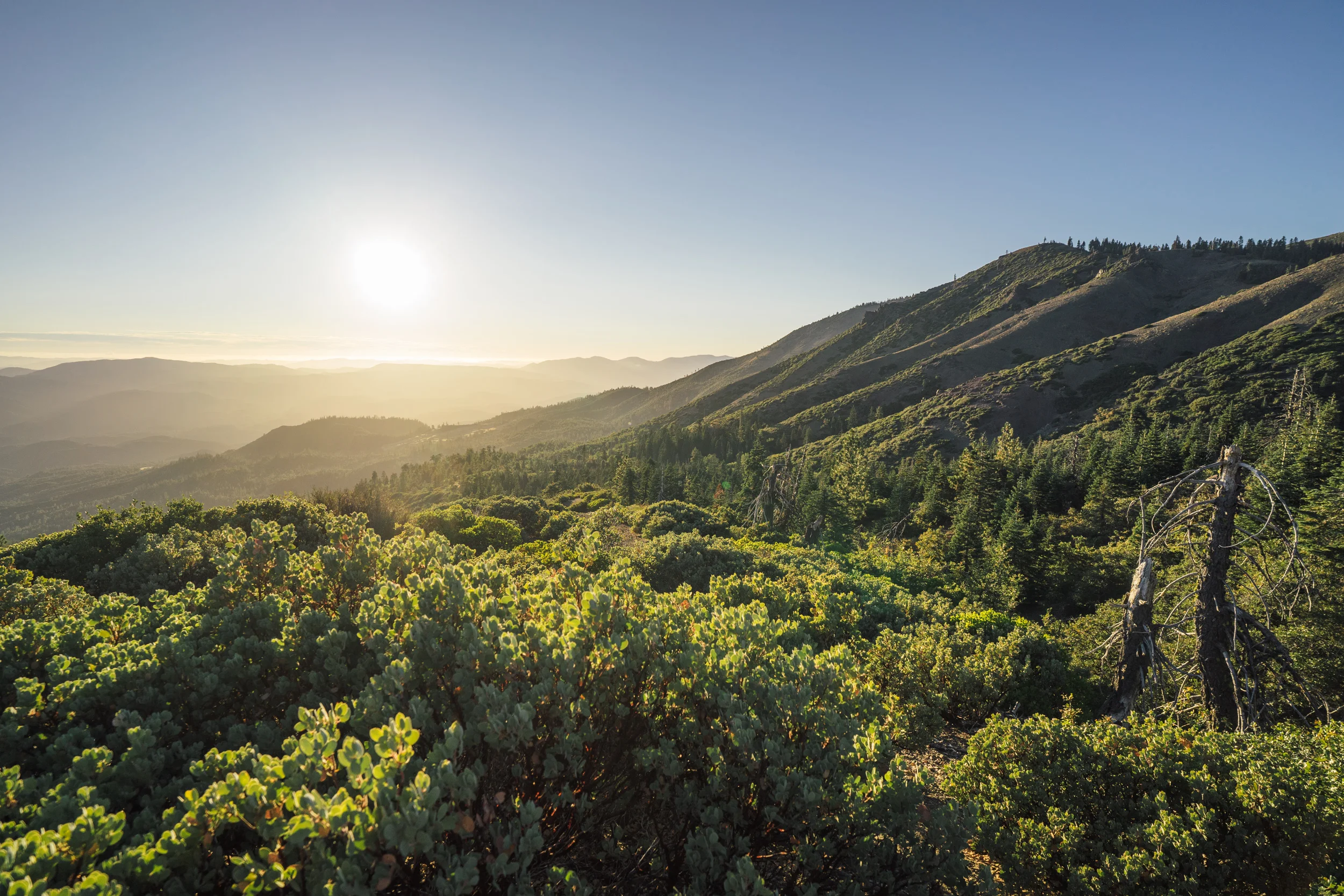
snow mountain summit hike
When hiking up Snow Mountain unparalleled views of the true wilderness that lies around open up. This is an area surrounded by large urban sprawls and productive agriculture, yet climbing up the ridge you have 360 degree views of untouched forest cover.

Coniferous forests take over the landscape when approaching the peaks of Snow Mountain

Almost at the top, the hike goes through an area which underwent a large wildfire in the past, but where young trees are already repopulating the slopes.

Columbian Black-tailed deer (Odocoileus hemionus columbianus)
A Columbian black-tailed deer (subspecies of the mule deer), after sprinting up the slope from the trail in front of us

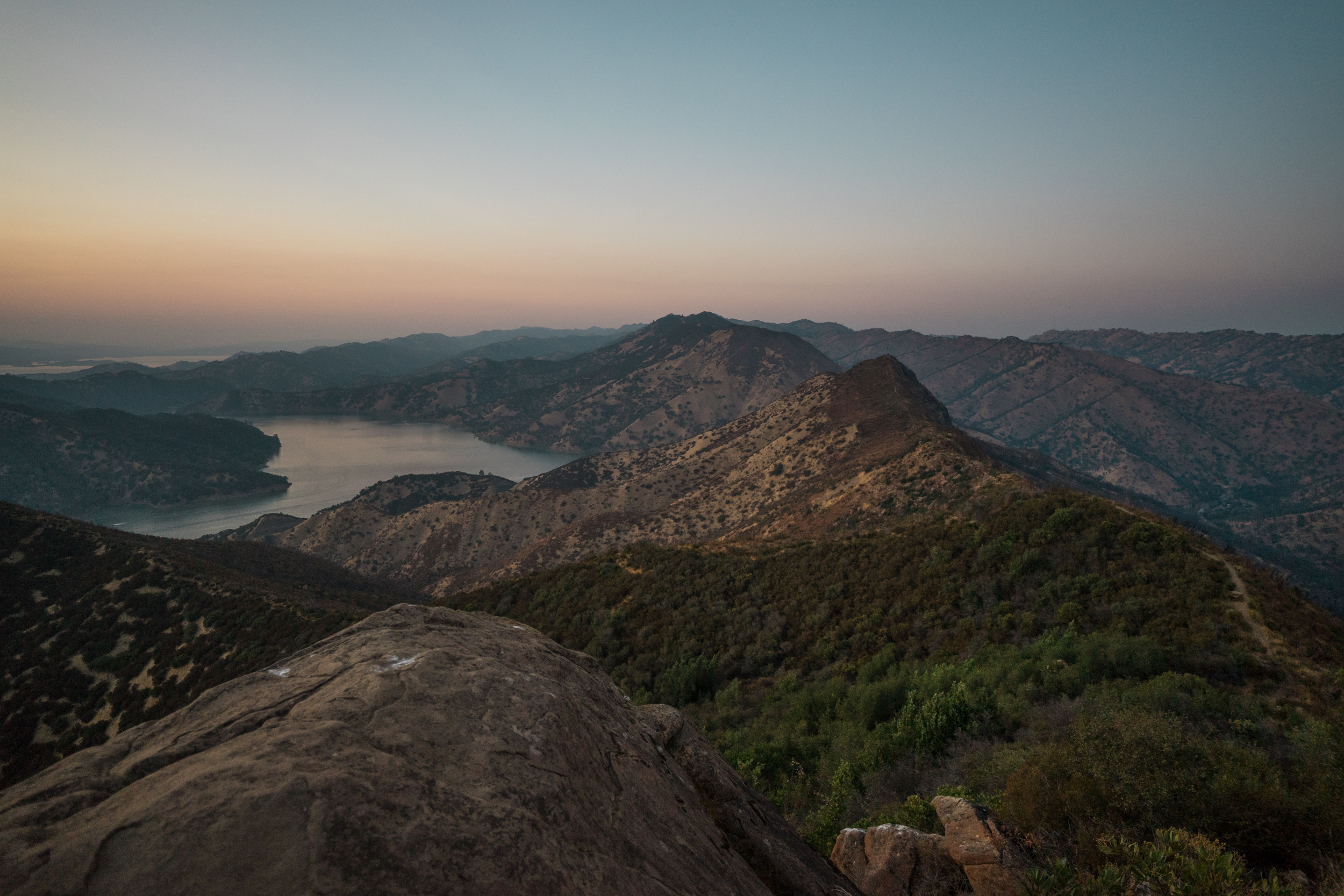
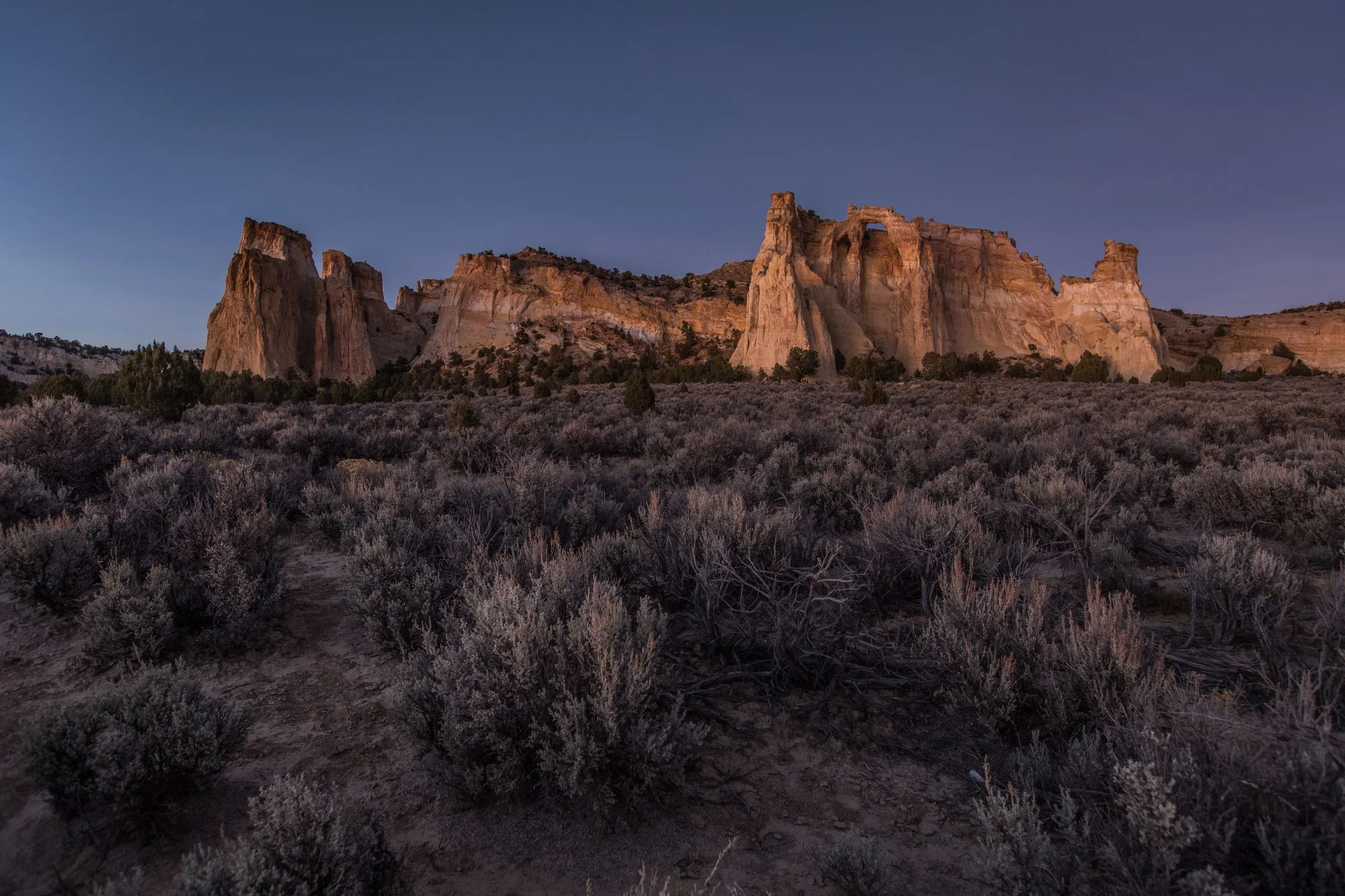
Looking at the Snow Mountain East peak from the southwest vantage point. There are actually two peaks that can be summited from the trail: the East one, and the West. Snow Mountain East is the highest peak in the Colusa and Lake counties, at 7,056 ft. Just .58 miles from it lies the western peak, slightly lower at 7,043 ft. Both peaks were extremely windy when we got up there. The Snow Mountain is believed to be an ancient sea mount from the Jurassic Period, when the entire area that now rises above ground was beneath the ocean. Nowadays the snow and waterways from the mountain feed into the Sacramento River and the Eel River Basin.

Heading back to our campsite in the sunset light. The Snow Mountain Wilderness is part of the Mendocino National Forest and is currently also included in the boundaries of the national monument.

northern Pacific rattlesnake (crotalus oreganus)
A northern Pacific rattlesnake making its way across the trail. If given space they will not react aggressively and will eventually move on at their slow pace. It was a magnificent sight, since it was the first one both of us ever spotted in the wild.

The Blue Ridge - Homestead hike
This hike reveals its true magic at sunset. It remains one of the most beautiful ridge hikes we've ever done and one of the most underestimated. The beginning of the hike doesn't look particularly special, but as the top gets closer, the beauty of the landscape around is revealed. We wouldn't imagine getting to the ridge at anytime but sunset or sunrise, as during day-time the heat and sunlight can be scorching.

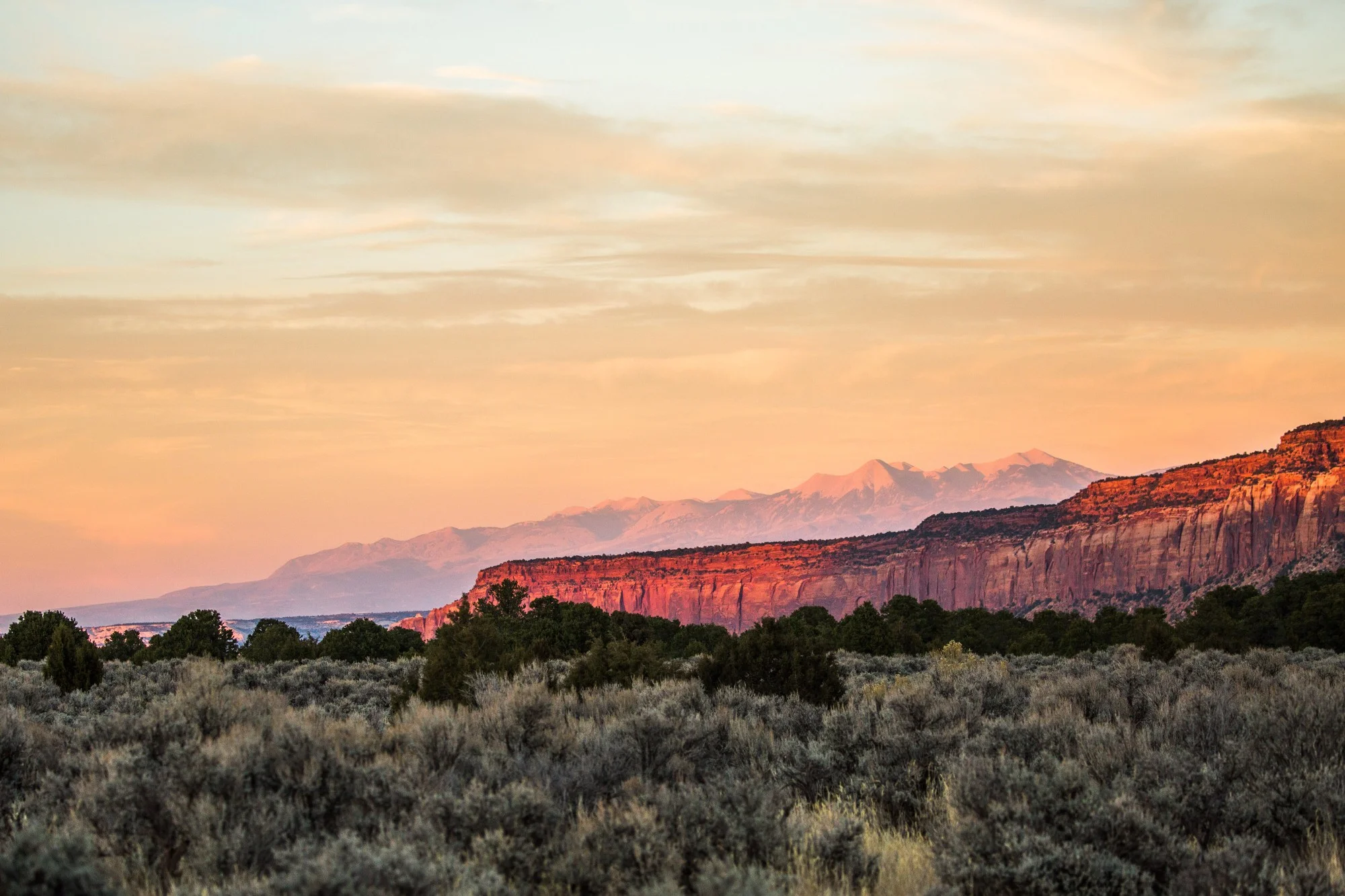
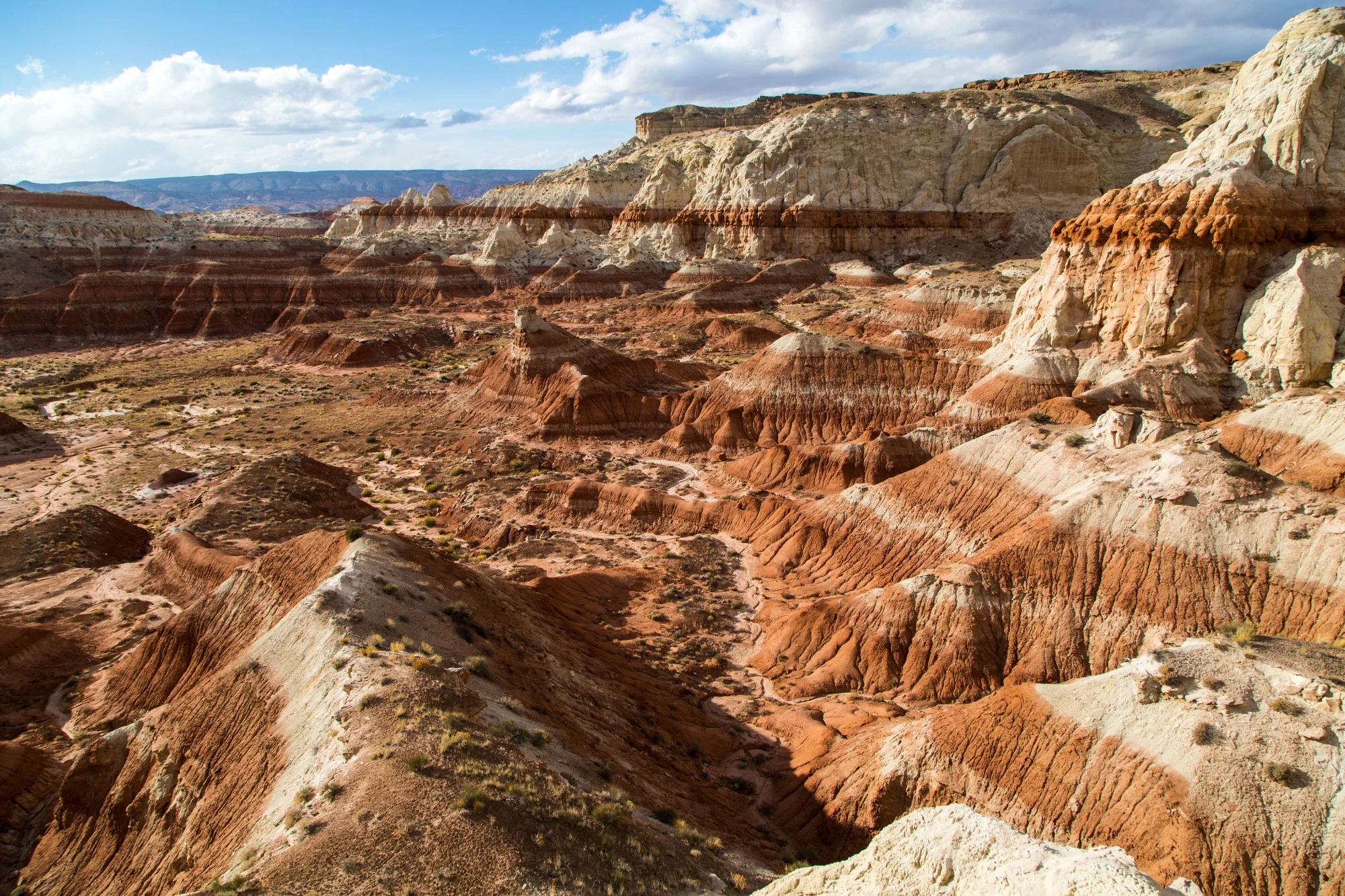
The arid mountains surrounding the southern portion of the national monument are partially covered by interior live oaks (Quercus wislizeni) that have survived extensive wildfires.
As night falls the views of the artificial Lake Berryessa are stunning and serene. The lake is a source of irrigation for the region, and of motorized recreation for the dozens of boats and ski jets crowding the resorts located on it. At the time of the creation of the monument the most vocal critics seemed to come from among those worried that the motorized recreation on the lake would be affected. The lake was left outside of the boundaries of the national monument.


To date, President Joe Biden has designated five national monuments since coming to office in 2021. Here we take a look at four of those five national monuments that had a land conservation element, and what might be on the slate before the end of his first term.